Drainage Strategy Report for Planning: A Step-by-Step Guide
A drainage strategy report for planning application is a statutory requirement for most new buildings and significant extensions in the UK. Without it, even well-designed projects face rejection from local authorities. This guide covers what planners expect, why your design matters, and how to avoid common rejection reasons.
What is a Drainage Strategy Report for Planning?
A drainage strategy report for planning application is a technical document demonstrating how surface water, foul water, and other liquid waste will be managed on your development site. It explains your approach across the entire development lifecycle, covering existing site conditions, proposed systems, maintenance responsibilities, and compliance with local authority standards.
The document typically runs 20-50 pages depending on site complexity, including site plans, calculations, risk assessments, and technical specifications. Critically, it demonstrates that you’ve followed the drainage hierarchy, the priority order for managing water that every local planning authority enforces.
Pro Tip
Local authorities receive dozens of planning applications monthly. A drainage strategy report planning that’s clear, well-organised, and addresses specific requirements gets fast-tracked. One that’s vague or incomplete gets sent back with conditions, adding months to your timeline.
Why Your Planning Application Needs a Drainage Strategy
Planning committees cannot approve developments that leave drainage to chance. Water management affects neighbouring properties, local infrastructure, flood risk, and environmental quality. Most councils now require a drainage strategy report planning before they’ll validate your application. Without it, your submission gets rejected at validation stage.
Beyond compliance, a strong drainage strategy demonstrates professional competence and builds confidence in your entire application. The alternative is planning conditions, approval “in principle” with conditions requiring you to submit drainage details later. This often triggers renegotiation with the local authority, additional surveys, or design changes that weren’t in your original cost estimates.
Watch Out
Planning conditions on drainage are common and expensive. A developer received approval with conditions requiring a permeability test they hadn’t budgeted for. The test revealed poor ground conditions, forcing a complete redesign of their surface water strategy, adding four months and significant costs. A comprehensive upfront drainage strategy report planning would have caught this in advance.
Understanding Drainage Design for Planning Applications
Drainage design for planning application follows a strict hierarchy. You cannot choose the easiest or cheapest option; you must follow the priority order set by planning policy and building regulations:
- Infiltration (first choice): Water soaks into the ground on-site through permeable paving, infiltration trenches, or soakaways
- Attenuation and discharge to a watercourse: If infiltration isn’t viable, water is stored temporarily then released slowly to a river, stream, or ditch
- Attenuation and discharge to a public sewer: Only when neither infiltration nor watercourse discharge is possible can you connect to the mains sewer system
Your drainage strategy report planning must explain why you’ve chosen your particular approach. If you’re proposing sewer discharge when infiltration might be possible, you need evidence (usually a percolation test) showing why infiltration won’t work.
Surface Water Management and Runoff Control
Surface water is rainwater falling on roofs, driveways, and paved areas. The planning system requires you to manage surface water at “greenfield rates” or better, your development should discharge no more water than the site did before development, even if now 80% covered in buildings and concrete.
Sustainable drainage systems (SuDS) achieve this through techniques including permeable paving, green roofs, attenuation ponds or basins, swales and ditches, and rain gardens. The specific combination depends on your site.
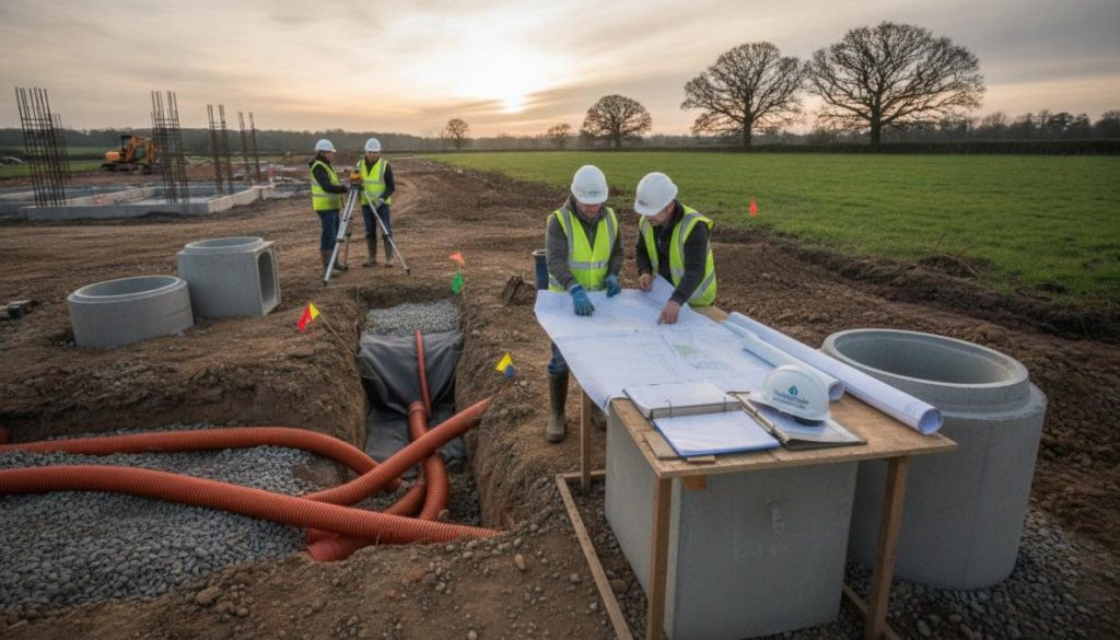
Your drainage strategy report planning must calculate the runoff rate from your proposed development and demonstrate that it doesn’t exceed the greenfield rate. This requires hydraulic modelling, accounting for rainfall intensity, ground permeability, and storage capacity.
Foul Water Drainage Systems
Foul sewage from toilets, showers, sinks, and washing machines must be treated before discharge, so it almost always goes to a public sewer or septic tank. For most developments, connection to the public mains sewer is standard. Your drainage strategy report planning needs to confirm the public sewer exists, has capacity, you have legal right of access, and the connection point is suitable.
If public sewers aren’t available (common in rural areas), you’ll need a septic tank or treatment plant, requiring more detailed design and ongoing maintenance agreements.
SuDS Report for Planning: Sustainable Drainage Systems Explained
A SuDS report for planning is the detailed expression of your surface water strategy, often a separate document within your broader drainage strategy report planning or a standalone submission depending on local authority requirements.
Most councils now expect SuDS in new developments. A SuDS report for planning typically includes site survey, runoff rate calculations, proposed SuDS techniques with drawings, maintenance and management plan, and biodiversity assessment.
The report must prove that your SuDS design achieves the required discharge rate through detailed calculations, not guesswork.
Key Takeaway
SuDS features do double duty: they manage surface water and provide environmental benefits. A retention pond becomes a wildlife habitat. Permeable paving reduces heat island effects. Green roofs support pollinators. Planners view SuDS as good design, not compliance burden.
Percolation Test for Drainage: What You Need to Know
A percolation test for drainage measures how quickly water soaks into the ground at your site. It’s the evidence you need to justify infiltration-based drainage design.
The test involves digging a hole, filling it with water, and measuring how fast the water level drops. Fast-draining sandy soils are ideal for infiltration; slow-draining clay soils are not. Most sites require multiple tests at different locations and depths.
A percolation test for drainage typically costs less than £500 per location but is essential if proposing infiltration-based SuDS. The test must be carried out to British Standard BS 1377 by a qualified drainage engineer or geotechnical surveyor. If results show poor drainage, you move down the hierarchy to attenuation and discharge to a watercourse or sewer.
Lead Local Flood Authority Requirements and Compliance
The Lead Local Flood Authority (LLFA) is the council department responsible for flood risk management. Your drainage strategy report planning must demonstrate compliance with LLFA requirements, which typically include demonstration that surface water discharge doesn’t exceed greenfield rates, flood risk assessment for developments in flood risk areas, sustainable drainage systems where feasible, maintenance and management plan, and consultation with water companies on sewer capacity.
The LLFA reviews your drainage strategy report planning as a statutory consultee. If they object, your planning application gets refused. Different LLFAs have different standards. Many publish guidance documents spelling out exactly what they expect in a drainage strategy report planning.
Pro Tip
Contact your LLFA early in the design process, not after finishing your drainage strategy. A 20-minute phone call can clarify requirements and save weeks of rework later.
Key Components of a Drainage Strategy Report
Site Topography and Catchment Analysis
Your drainage strategy report planning must begin with a thorough site survey including existing ground levels and slope direction, existing drainage features, soil types and permeability, nearby watercourses, flood risk zone classification, and ground conditions from boreholes or trial pits.
The catchment area is the land uphill from your site that drains water onto your property. You’re responsible for managing not just water falling on your development, but also water flowing from uphill. This analysis determines whether you have space for infiltration or attenuation features.
Flood Risk Assessment Integration
A flood risk assessment (FRA) is a separate document that integrates closely with your drainage strategy report planning, examining risk of flooding from rivers, streams, surface water, groundwater, sewers, and climate change impacts. If your site is in a flood risk area, your drainage strategy must demonstrate that the development won’t increase flood risk to the site itself or neighbouring properties.
Hydraulic Modelling and Discharge Rates
Hydraulic modelling calculates water movement through your proposed drainage system using rainfall data, site dimensions, and pipe sizes. Your drainage strategy report planning must demonstrate that the system handles the design storm, typically a 1-in-100-year rainfall event with climate change allowance.
Professional hydraulic modelling software produces detailed predictions showing whether your system floods during extreme events, where water accumulates, and discharge rates. If your site currently discharges at 5 litres per second to the public sewer, your new development must discharge at the same rate or less, requiring storage capacity to hold excess water temporarily.
| Component | Purpose | Typical Content |
|---|---|---|
| Site Survey | Establish baseline conditions | Ground levels, soil types, existing drainage |
| Catchment Analysis | Identify water sources | Area calculations, slope direction, uphill land |
| SuDS Design | Propose infiltration/attenuation | Feature drawings, maintenance plans |
| Hydraulic Model | Prove system performance | Rainfall scenarios, discharge rates, storage volumes |
| Flood Risk Assessment | Evaluate flood risk | Hazard mapping, mitigation measures |
| Maintenance Plan | Ensure long-term performance | Responsibility assignment, inspection schedules |
Common Reasons for Drainage Strategy Rejection
Insufficient infiltration testing. Applicants propose infiltration-based SuDS without percolation test results. Fix: commission proper percolation testing before finalising your drainage strategy report planning.
Discharge rates exceed greenfield. Hydraulic modelling shows the development discharges more water than the undeveloped site. Fix: increase attenuation storage or reduce impermeable surface area.
No consideration of SuDS. The drainage strategy jumps straight to sewer discharge without explaining why SuDS options were rejected. Fix: demonstrate that you’ve genuinely considered infiltration and watercourse discharge before defaulting to sewers.
Unclear maintenance responsibility. The drainage strategy describes SuDS features but doesn’t explain who maintains them. Fix: assign clear maintenance responsibility with detailed maintenance schedules.
Conflict with flood risk assessment. The drainage strategy doesn’t match the flood risk assessment. Fix: ensure both documents are prepared together and tell the same story.
Missing LLFA consultation. The application doesn’t reference LLFA requirements or guidance. Fix: contact the LLFA early and reference their requirements explicitly.
Inadequate calculations. The drainage strategy contains vague statements without actual numbers. Fix: commission hydraulic modelling from a qualified engineer and include detailed results.
Unrealistic maintenance plans. The strategy proposes features that can’t be realistically maintained. Fix: ensure maintenance is actually feasible given site constraints and user behaviour.
A drainage strategy report for planning application is non-negotiable for modern developments. The planning system demands it, the LLFA expects it, and your project’s success depends on getting it right. The Drainage Designers (Woodvale consulting Ltd) specialises in creating drainage strategies that planners approve on first submission, combining site-specific analysis, hydraulic modelling, and deep knowledge of local authority requirements. Whether managing a small house extension or a major residential development, we simplify the complex process and guide you from initial survey through final approval.
Frequently Asked Questions
What should be included in a drainage strategy report for planning?
A comprehensive drainage strategy report must include site topography analysis, catchment area assessment, flood risk evaluation, proposed drainage design (surface water and foul water systems), SuDS recommendations, hydraulic modelling data, discharge rates, percolation test results where applicable, maintenance plans, and confirmation of local planning authority and Lead Local Flood Authority compliance. The report should also address how the design meets the drainage hierarchy and any necessary discharge consents.
What is a percolation test for drainage and why is it required?
A percolation test measures how quickly water infiltrates into the ground at your site. It determines whether infiltration-based drainage solutions (such as soakaways or permeable paving) are viable. The test involves digging trial pits, saturating the soil, and measuring water absorption rates. Local planning authorities and the Lead Local Flood Authority often require percolation test results to justify proposed SuDS and sustainable drainage methods.
How do SuDS relate to my drainage strategy report for planning?
Sustainable Drainage Systems (SuDS) are a key component of modern drainage strategies. They manage surface water runoff through natural processes such as infiltration, attenuation, and filtration using features like permeable paving, green roofs, and retention ponds. Planning authorities expect your drainage strategy report to demonstrate how SuDS have been considered in the design hierarchy and why they are or are not appropriate for your site, based on site conditions and ground permeability.
What are the most common reasons a drainage strategy report gets rejected by the council?
Typical rejection reasons include insufficient flood risk assessment, failure to demonstrate compliance with the drainage hierarchy, inadequate SuDS consideration, unrealistic discharge rates that exceed local watercourse capacity, poor integration with Lead Local Flood Authority requirements, missing geotechnical data, and lack of maintenance and management plans. Non-compliance with local planning authority specific guidance or failure to address statutory consultee comments also leads to rejection. Early engagement with your local authority helps avoid these pitfalls.