
Drainage Strategy for Minor Planning: A 2026 Guide
Table of Contents
- What is a drainage strategy for minor planning applications?
- When is a drainage strategy required for planning permission?
- SuDS requirements for small developments
- Surface water drainage strategy template and what to include
- Flood risk assessment for planning permission
- Common reasons for planning refusal on drainage grounds
- Validation checklist for your drainage strategy submission
- Conclusion
Last Updated: August 18, 2026
What is a drainage strategy for minor planning applications?
A drainage strategy for minor planning applications is a technical document that demonstrates how surface water will be managed on a development site in compliance with planning regulations and local authority requirements. It forms part of the planning submission and sets out the proposed drainage infrastructure, design principles, and how the development meets statutory guidelines for water management.
At The Drainage Designers (Woodvale consulting Ltd), we recognise that even small-scale residential extensions and minor developments require careful drainage planning. The document typically includes site plans showing existing and proposed drainage layouts, calculations for surface water runoff, details of proposed sustainable drainage systems (SuDS), and confirmation that the design meets the drainage hierarchy established in planning policy.
The purpose of this document is straightforward: to convince the local planning authority that your development will not increase flood risk, will manage water responsibly, and complies with environmental and building control requirements. Without a properly prepared drainage strategy for minor planning applications, your submission risks rejection or conditions that delay your project.
When is a drainage strategy required for planning permission?
A drainage strategy is required when your minor development involves new or altered impermeable surfaces that affect surface water drainage. This typically includes residential extensions with new driveways, patios, or roof areas; new build properties; and conversions that increase the built footprint.
The threshold for requiring a drainage strategy depends on your local planning authority’s specific policy. Many authorities require a drainage statement for any development involving more than 100 square metres of new impermeable surface. Others apply the requirement more broadly to any minor development that changes the site’s drainage characteristics.
You should check your local planning authority’s validation requirements before submitting. Some councils demand a full drainage strategy for minor applications; others accept a simplified drainage statement. The difference is significant: a drainage statement may be a single page addressing basic principles, whilst a full strategy includes detailed calculations, site surveys, and technical drawings.
If your site is in a flood risk area or within a critical drainage area designated by the Lead Local Flood Authority, a drainage strategy becomes non-negotiable. Similarly, if your development is on previously developed (brownfield) land or involves significant earthworks, the local authority will expect comprehensive drainage documentation.
SuDS requirements for small developments
Sustainable Drainage Systems (SuDS) are now a standard requirement in planning policy across the UK. For minor developments, SuDS requirements are proportionate to the scale of the project but remain mandatory in most circumstances.
The drainage hierarchy established in planning guidance requires developers to manage surface water in this order: infiltration first, then attenuation and conveyance, then discharge to a watercourse, and finally discharge to a sewer as a last resort. For small residential developments, this often means proposing permeable paving, soakaways, or rain gardens rather than traditional piped drainage connected directly to the public sewer.
A common mistake is treating SuDS as optional or purely environmental. In reality, local planning authorities now view SuDS compliance as non-negotiable for planning permission. If your minor development proposal lacks a credible SuDS strategy, expect a refusal or conditions requiring redesign.
The practical application depends on site conditions. A property with good drainage soil and adequate space might use a soakaway or infiltration trench. A constrained urban site might employ permeable paving with underground storage or a green roof. The key is demonstrating that you have considered the drainage hierarchy and selected the most appropriate solution for your specific site.
The Environmental Agency and local planning authorities publish SuDS design guidance that sets out technical standards for each approach. Your drainage strategy must reference these standards and confirm that your proposed SuDS meets them. This is where many minor applications fall short: developers propose SuDS without the supporting calculations or design detail that validates the approach.
Surface water drainage strategy template and what to include
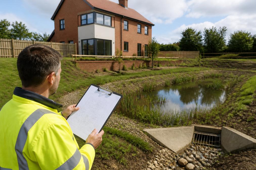
A surface water drainage strategy for minor planning applications should include a clear structure covering site context, existing drainage conditions, proposed drainage design, and compliance confirmation. The template structure varies slightly between local authorities, but core elements remain consistent.
Start with a site location plan showing the property boundaries, existing buildings, and proposed development extent. Add a site survey plan identifying existing drainage features, ground levels, soil conditions, and any constraints such as trees or services. This foundation establishes the baseline against which your proposed drainage is assessed.
Next, include your proposed drainage layout plan. This drawing should show all new and retained drainage infrastructure: surface water pipes, gullies, soakaways, permeable surfaces, attenuation features, and outfalls. Use clear symbols and labelling so the local authority can immediately understand your design intent.
Include calculations for greenfield runoff rates and proposed discharge rates. The drainage hierarchy requires you to match or reduce existing runoff, so these calculations are critical. You will need to determine the site’s soil infiltration rate, typically through a simple percolation test, to justify your proposed SuDS approach.
Add a brief design statement explaining your choice of SuDS and how it meets the drainage hierarchy. This need not be lengthy for minor applications, but it must demonstrate that you have considered alternatives and selected the most appropriate solution for your specific site.
Finally, include confirmation that your design complies with local planning policy, Building Regulations, and any specific requirements set out in the local planning authority’s validation checklist. A statement confirming that the design has been prepared in accordance with relevant standards (such as BS 8601 or CIRIA guidance) adds credibility.
We can prepare a surface water drainage strategy template tailored to your local authority’s specific requirements, ensuring your submission meets validation criteria first time.
| Element | Purpose | Key Detail |
|---|---|---|
| Location plan | Establish site context | Boundaries, existing buildings, development extent |
| Survey plan | Baseline drainage assessment | Levels, soil type, existing features, constraints |
| Proposed layout | Show drainage design | Pipes, gullies, SuDS, outfalls, conveyance routes |
| Runoff calculations | Justify discharge rates | Greenfield rate, proposed rate, infiltration data |
| Design statement | Explain SuDS selection | Why this approach meets the drainage hierarchy |
| Compliance confirmation | Regulatory alignment | Planning policy, Building Regulations, standards |
Flood risk assessment for planning permission
A flood risk assessment (FRA) is often required alongside your drainage strategy, particularly if your site is in a flood risk zone or near a watercourse. The assessment examines both the risk of flooding to your development and the impact of your development on flood risk elsewhere.
For minor residential developments on sites with low flood risk, the FRA may be brief. However, if your site is in Flood Zone 2 or 3, or within a critical drainage area, expect a more detailed assessment. The Environment Agency’s guidance sets out the scope and technical requirements.
The assessment should identify all sources of flooding: surface water, groundwater, sewers, and watercourses. It must then evaluate the likelihood and consequence of each source affecting your development. For surface water specifically, you must demonstrate that your proposed drainage strategy will not increase flood risk on neighbouring properties.
A key requirement is showing that your development incorporates flood resilience or resistance measures where appropriate. For minor applications, this might be as simple as setting finished floor levels above the predicted flood level or ensuring that critical services are positioned above flood risk. The local planning authority will expect evidence that these measures have been properly calculated.
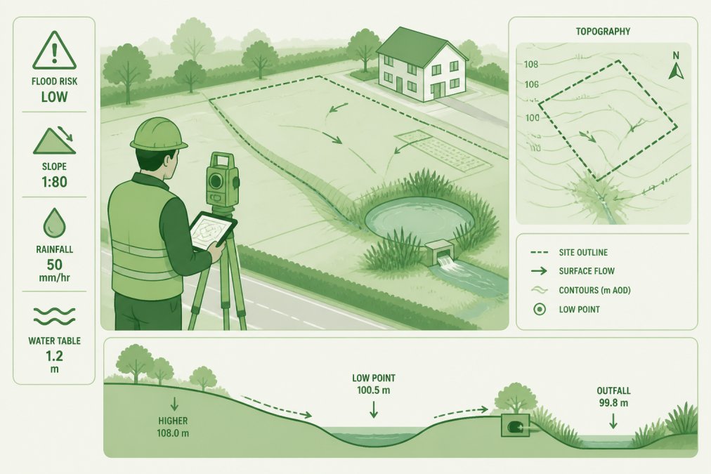
The FRA must be prepared in accordance with the Environment Agency’s guidance and any supplementary guidance from your local planning authority or Lead Local Flood Authority. Many minor applications fail validation because the FRA lacks the necessary technical detail or does not address all sources of flooding.
Common reasons for planning refusal on drainage grounds
Understanding why planning applications are refused on drainage grounds helps you avoid the same mistakes. The most common reason is an inadequate or missing drainage strategy. If your submission lacks clear evidence that surface water will be managed responsibly, the local authority will refuse permission.
A second frequent cause of refusal is failure to demonstrate compliance with the drainage hierarchy. Proposing a piped connection to the public sewer when infiltration or attenuation would be feasible signals to the local authority that you have not properly considered alternatives. This triggers a refusal.
Inadequate SuDS design is another common ground for refusal. Proposing a soakaway without soil percolation testing, or claiming infiltration is possible without supporting evidence, will not survive scrutiny. The local planning authority now expects SuDS proposals to be backed by proper site investigation and design calculations.
Flood risk assessment gaps also lead to refusal. If your FRA does not address all flood sources, or if it fails to demonstrate that your development will not increase flood risk to neighbouring properties, the local authority will refuse. This is particularly common when developments near watercourses lack proper FRA detail.
Conflict with local planning policy is another reason for refusal. Some local authorities have adopted specific drainage standards or SuDS requirements in their local plan. If your drainage strategy does not explicitly confirm compliance with these policies, expect a refusal or conditions requiring redesign.
Finally, poor presentation or missing information triggers validation rejection. If your drainage strategy lacks clear plans, calculations, or design statements, the local authority will not validate your application. This delays your project and frustrates the planning process.
Validation checklist for your drainage strategy submission
Before submitting your planning application, use this validation checklist to confirm your drainage strategy meets local authority requirements. This approach reduces the risk of validation rejection and accelerates the approval process.
Start by confirming that your submission includes all documents required by your local planning authority’s validation checklist. Most councils publish this checklist online. Common requirements include a drainage strategy document, site location plan, site survey plan, proposed drainage layout, and calculations supporting your proposed discharge rates.
Check that your site survey plan shows all relevant information: existing ground levels, soil conditions, existing drainage features, watercourses, and any constraints. The survey must be sufficiently detailed that the local authority can assess whether your proposed drainage is feasible.
Verify that your proposed drainage layout plan is clear and uses standard symbols. The plan should show all surface water pipes, gullies, permeable surfaces, attenuation features, and outfalls. Use colour coding or clear labelling to distinguish new features from retained ones.
Confirm that you have calculated greenfield runoff rates and proposed discharge rates in accordance with the relevant standard (typically the Flood Estimation Handbook method or similar). Include the calculation methodology and show all working. If you are proposing infiltration, include evidence of soil percolation testing.
Check that your design statement explains why you have chosen your proposed SuDS approach and how it meets the drainage hierarchy. The statement should reference relevant standards and confirm compliance with local planning policy.
- All required documents listed in local authority validation checklist included
- Site survey plan shows ground levels, soil type, existing drainage, constraints
- Proposed drainage layout is clear with standard symbols and colour coding
- Greenfield and proposed discharge rates calculated and documented
- Soil percolation testing completed if infiltration is proposed
- Design statement explains SuDS selection and drainage hierarchy compliance
- Compliance confirmation references planning policy and relevant standards
- Flood risk assessment completed if site is in flood risk area or near watercourse
- All plans are legible, to scale, and clearly labelled
- Calculations use recognised methodology and show all working
Confirm that any flood risk assessment has been completed to the required standard if your site is in a flood risk zone. The FRA must address all flood sources and demonstrate that your development will not increase flood risk elsewhere.
Finally, review your entire submission for completeness and clarity. Missing or unclear information will trigger validation rejection and delay your project. A thorough check at this stage prevents frustration later.
Getting your drainage strategy right from the start makes the difference between planning permission granted on first submission and rejection followed by costly redesign. The Drainage Designers (Woodvale consulting Ltd) prepares drainage strategies tailored to your local authority’s specific validation requirements, incorporating site survey data, SuDS design, and flood risk assessment in a single coherent submission. Contact us for a site visit and professional drainage strategy that maximises your planning permission success.
Frequently Asked Questions
Do all minor planning applications require a formal drainage strategy?
Not all minor developments require a full drainage strategy, but most do. If your minor planning application involves new buildings, extensions with impermeable surfaces, or changes to surface water drainage, your local planning authority will typically require one. Applications for internal alterations or minor works may not need a drainage strategy. Check with your local planning authority early to confirm requirements for your specific project, as criteria vary by location and flood risk zone.
What is the difference between a drainage strategy and a flood risk assessment?
A drainage strategy focuses on how surface water will be managed on your site, including design, discharge rates, and SuDS measures. A flood risk assessment evaluates the site's vulnerability to flooding from various sources (surface water, groundwater, rivers) and recommends mitigation. Both may be needed: the flood risk assessment identifies the risk, and the drainage strategy demonstrates how you will manage water safely. For minor developments in low-risk areas, a simplified assessment may suffice.
What SuDS measures work best for small residential extensions?
For small extensions, practical SuDS options include permeable paving for driveways and patios, rain gardens or bioswales to capture runoff, soakaways for infiltration, and green roofs where feasible. The best choice depends on your site's soil conditions, drainage hierarchy requirements set by your local authority, and available space. Permeable surfaces and soakaways are often most cost-effective for residential projects. Your drainage designer should assess site-specific conditions to recommend the most suitable SuDS for your development.
What happens if my drainage strategy is rejected by the local planning authority?
Rejections typically occur when the strategy fails to meet statutory requirements, doesn't follow the drainage hierarchy, lacks sufficient detail, or proposes discharge rates that exceed greenfield runoff. Common issues include inadequate attenuation, unclear outfall details, or missing hydraulic calculations. Most rejections are resolvable with revised plans addressing specific feedback. Working with an experienced drainage designer from the start minimises refusal risk by ensuring your submission meets local authority standards and validation checklists before formal submission.
How quickly can a drainage strategy be prepared for a minor planning application?
Timescale depends on site complexity and data availability. A straightforward extension on a small, low-risk site might be completed in 2-3 weeks after a site visit. More complex projects involving detailed flood risk assessment, SuDS design, or hydraulic calculations may take 4-8 weeks. Early engagement with your drainage designer and local planning authority helps avoid delays. Providing clear site information, existing drainage records, and flood risk data upfront accelerates the process significantly.
Can I use a standard drainage strategy template for my minor planning application?
A template provides useful structure, but your drainage strategy must be site-specific. Each property has different soil conditions, existing drainage infrastructure, flood risk profiles, and local authority requirements. A generic template without site survey data, hydraulic calculations, and local context will likely be rejected. Your strategy should address your site's unique characteristics, comply with your specific local planning authority's standards, and demonstrate how SuDS and discharge management apply to your development. Professional tailoring is essential.
Does my small extension need SuDS if the site is low-risk for flooding?
Yes. Even on low-risk sites, SuDS requirements apply to most minor developments. The Building Regulations and planning policy require sustainable drainage principles regardless of flood risk classification. Your strategy must demonstrate that surface water is managed using the drainage hierarchy: infiltration first, then attenuation and conveyance, with discharge to watercourse or sewer as a last resort. SuDS measures may be modest (permeable paving, a soakaway), but they must be included and justified in your drainage strategy.
This article was written using GrandRanker