
How to Prepare a Drainage Strategy Report
Table of Contents
- Understanding What a Drainage Strategy Report Requires
- Step 1: Conduct a Site Assessment and Topographical Survey
- Step 2: Perform a Flood Risk Assessment and Identify Site Constraints
- Step 3: Design Your SuDS Pro-Forma Requirements and Drainage Hierarchy
- Step 4: Calculate Attenuation Volumes and Discharge Rates
- Using a Drainage Strategy Report Template and Timeline
- How Long Does a Drainage Strategy Take to Prepare
- Addressing Planning Drainage Objections and Common Rejection Reasons
- Frequently Asked Questions
Last Updated: September 25, 2026
Understanding What a Drainage Strategy Report Requires
A drainage strategy report is a detailed technical document that demonstrates how surface water will be managed on your development site. It shows local authorities and the Lead Local Flood Authority that your project meets current planning policy and flood risk requirements.
The report proves your design manages water safely, reduces flood risk, and complies with building regulations. Without it, your planning application faces rejection or delays.
The Drainage Designers (Woodvale consulting Ltd) prepares drainage strategy reports.
Step 1: Conduct a Site Assessment and Topographical Survey
Start by understanding your site physically. A topographical survey records ground levels, existing features, and site constraints that affect drainage design.
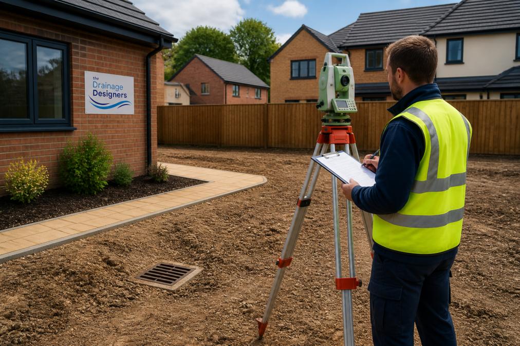
Your surveyor should map ground levels, existing drainage infrastructure, slopes and flow paths, buildings and hard surfaces, trees, and proximity to watercourses or flood zones.
A geotechnical investigation determines soil type and infiltration potential, establishing whether soakaways are viable. Document site constraints early: shallow bedrock, high water tables, or nearby property lines limit your options and prevent costly redesigns.
Step 2: Perform a Flood Risk Assessment and Identify Site Constraints
A flood risk assessment determines whether your site sits in a flood zone, the probability of flooding from rivers or surface water, and how climate change increases rainfall intensity over the building’s lifetime.
The Environment Agency publishes climate change guidance requiring your drainage design to accommodate increased rainfall intensity (Flood risk assessments: climate change allowances).
Identify site constraints: proximity to public sewers, easements, underground utilities, contaminated land, and protected habitats. These shape what drainage solutions are feasible.
Step 3: Design Your SuDS Pro-Forma Requirements and Drainage Hierarchy
Sustainable Drainage Systems, or SuDS, are now the standard approach for managing surface water. Your drainage strategy report must explain how your design follows the SuDS hierarchy.
The SuDS hierarchy prioritises solutions in this order:
- Infiltration (allowing water to soak into the ground)
- Attenuation and conveyance (storing and moving water on site)
- Discharge to surface water bodies
- Discharge to public sewers (only if other options fail)
Start with infiltration. If site conditions allow soakaways or permeable paving, these are preferred. If infiltration isn’t viable, move to attenuation, which means storing water temporarily during heavy rainfall, then releasing it slowly through balancing ponds or underground storage tanks.
Your SuDS pro-forma should detail which measures you’re using, how each manages water quality, maintenance requirements, and system performance. The management train concept uses multiple smaller interventions: permeable paving feeds to a swale, which feeds to a retention basin, treating water at each step.
Step 4: Calculate Attenuation Volumes and Discharge Rates
Attenuation volume is calculated using rainfall data, site area, rainfall intensity for a 1-in-100-year storm, climate change allowance (40% uplift), and existing greenfield run-off rates.
The greenfield run-off rate is your baseline. Your designed discharge rate must not exceed it, even after development.
Discharge rates are measured in litres per second. If discharging to a public sewer, the water company sets maximum limits; if to a watercourse, the Environment Agency sets requirements.
Use hydraulic modelling software to test your design. These tools simulate rainfall events and show whether your attenuation volume is sufficient, revealing potential bottlenecks and helping you optimise the system before construction.
Using a Drainage Strategy Report Template and Timeline
A drainage strategy report template ensures you include all required sections and keeps documentation consistent.
Standard sections include executive summary, site description, flood risk assessment, drainage hierarchy justification, SuDS design details, calculations, maintenance arrangements, and compliance statement.
Your report should include drawings showing site layout, cross-sections, outfall locations, and maintenance access routes. Clear visuals reduce questions and speed up approval.
How Long Does a Drainage Strategy Take to Prepare
Timeline depends on site complexity and data availability. Understanding the full submission workflow is critical to avoiding delays.
Pre-Submission Phase (Weeks 1-4)
Before writing the drainage strategy report, gather baseline information and conduct pre-application discussions with your local authority.
Week 1: Commission a topographical survey and geotechnical investigation. Contact your local planning authority and Lead Local Flood Authority to request their specific requirements for drainage strategy reports. This prevents wasted effort on designs that won’t meet local expectations.
Weeks 2-3: Begin your flood risk assessment using Environment Agency flood maps and climate change allowances. Identify your proposed outfall point and secure preliminary written agreement from the relevant party (water company, Environment Agency, or neighbouring property owner).
Week 4: Sketch your initial drainage design and document why you’ve chosen your SuDS approach, explaining why earlier options in the hierarchy don’t work.
Report Preparation Phase (Weeks 5-8)
Weeks 5-6: Calculate attenuation volume and discharge rates using survey data and rainfall information. Run hydraulic modelling to simulate your design against a 1-in-100-year storm plus climate change allowance. Allow time for iterations if results show insufficient storage or excessive discharge.
Weeks 7-8: Compile findings into the formal drainage strategy report with site layout drawings, cross-sections, and outfall plans. Draft a detailed maintenance plan naming the responsible party and specifying inspection schedules.
Submission and Approval Phase (Weeks 9-12+)
Week 9: Submit your drainage strategy report alongside your planning application, clearly labelled and cross-referenced in your planning statement.
Weeks 10-12: The planning authority and Lead Local Flood Authority review your report (typically 4-6 weeks). Common requests include revised calculations, maintenance detail, outfall point confirmation, or amended drawings.
Weeks 12+: If the authority raises objections, revise the report and resubmit. Minor revisions typically take 1-2 weeks; major revisions can add 4-8 weeks.
Timeline Variability
Common causes of delay include outfall point not pre-agreed (4-8 weeks), unexpected soil conditions (2-3 weeks), local authority policy changes, maintenance plan ambiguity (1-2 weeks), and neighbouring property concerns (2-4 weeks).
How to Protect Your Timeline
Start the pre-submission phase early. Contact your local authority and Lead Local Flood Authority before commissioning surveys. Secure outfall point approvals in writing before designing the system. Submit a complete, well-drawn report with a clear management plan.
Addressing Planning Drainage Objections and Common Rejection Reasons
Planning applications get rejected on drainage grounds for predictable reasons. Understanding why and how to fix it is the difference between a report that passes first time and one that triggers multiple revisions.
Inadequate Attenuation Volume
Your calculations show insufficient storage for a 1-in-100-year rainfall event plus climate change allowance. Common causes: outdated rainfall figures, underestimated catchment area (excluding roofs and driveways), overestimated infiltration losses, or missing climate change allowance.
How to fix it: Rerun hydraulic modelling with the latest Environment Agency climate change guidance.
Discharge Rate Exceeds Greenfield Run-Off
Your design releases water faster than natural undeveloped land. Greenfield run-off rate is typically 2 litres/second/hectare for a 1-in-1-year rainfall event. Your discharge rate must not exceed this baseline.
Insufficient SuDS Measures
You’ve jumped straight to a pond without exploring infiltration or permeable surfaces. The SuDS hierarchy requires justification for why earlier options don’t work.
Unclear or Missing Maintenance Arrangements
The authority cannot identify who will maintain the drainage system long-term. Without a named responsible party and detailed maintenance plan, they cannot approve the development.
Outfall Point Not Approved
You’ve proposed a discharge location without securing written consent from the relevant party. The authority will not approve your design until confirmed.
Missing or Outdated Climate Change Allowance
Your flood risk assessment uses rainfall figures that don’t account for future climate impacts. Current guidance requires a 40% uplift on rainfall intensity for developments with a lifetime beyond 2070.
Contaminated Land Not Addressed
Your site has industrial or commercial history, and you haven’t assessed whether drainage design will mobilise contaminants. Water percolating through soil or running across the surface can carry contaminants into groundwater or surface water bodies.
| Common Rejection Reason | Root Cause | Prevention Strategy |
|---|---|---|
| Inadequate attenuation volume | Undersized storage; missing climate allowance | Rerun modelling with 40% rainfall uplift; increase pond/tank size |
| Discharge rate too high | No flow control; exceeds greenfield rate | Install orifice plate or throttle valve; confirm water company limit |
| Insufficient SuDS measures | Skipped infiltration step | Conduct geotechnical testing; incorporate permeable surfaces |
| Unclear maintenance plan | No named responsible party | Name management company; draft detailed maintenance schedule |
| Outfall not approved | No written consent from water company/EA | Secure preliminary approval before finalising design |
| Missing climate allowance | Used outdated rainfall figures | Apply current 40% uplift; recalculate volume and discharge |
| Contaminated land ignored | No environmental assessment | Commission Phase 1/2 assessment; design contamination-aware drainage |
Frequently Asked Questions
What is a drainage strategy report and what information does it provide?
A drainage strategy report is a technical document submitted to your local planning authority demonstrating how surface water will be managed on your development site. It includes site assessment findings, flood risk analysis, proposed drainage systems (including SuDS options), attenuation volumes, discharge rates, and a maintenance schedule. The report proves your scheme complies with planning policy and national guidance, addressing requirements from the Lead Local Flood Authority and local planning policy statements. For residential extensions and new builds, this report is often the deciding factor in planning approval.
Do I need a drainage strategy report for a small-scale planning application?
Most planning applications involving new buildings, extensions with impermeable surfaces, or changes to surface water drainage require a drainage strategy report. Even small residential extensions may need one if they increase surface water run-off or affect existing drainage. Your local planning authority’s validation checklist will specify whether one is required. When in doubt, contact your authority early in the process. Submitting a compliant report upfront prevents delays and rejection.
How long does a drainage strategy take to prepare?
Preparation time depends on site complexity and data availability. Early engagement with your local planning authority about their specific requirements helps avoid delays. Planning ahead ensures your submission meets validation deadlines.
What should I include in a drainage strategy report template?
A complete drainage strategy report template should contain: executive summary, site location and constraints, existing drainage conditions, flood risk assessment findings, proposed SuDS design with management train details, attenuation and storage calculations, discharge rates and outfall points, surface water run-off reduction strategies, water quality treatment measures, maintenance and management arrangements, compliance checklist against planning policy, and supporting appendices (surveys, modeling results, calculations). Using a structured template ensures nothing is missed and speeds up preparation. Your local planning authority may have specific pro-forma requirements or templates available.