How to Get Planning Permission for Drainage: A Step-by-Step Guide
Understanding Drainage Planning Permission Requirements
How to get planning permission for drainage depends on the specific nature of your project and local authority requirements. This guide from The Drainage Designers (Woodvale consulting Ltd) covers the essential steps to secure approval for residential and commercial drainage systems across the UK. Understanding when drainage plans trigger planning permission saves time, money, and prevents costly rejections.
Not all drainage projects require planning permission. The distinction hinges on whether your drainage work affects flood risk, environmental impact, or neighbouring properties. A new soakaway serving a single-storey extension may not require it, whilst a new foul water connection to a public sewer or surface water system discharging to a watercourse typically does.
When drainage plans trigger planning permission
Planning permission becomes necessary when your drainage system involves significant ground works, changes to surface water discharge, or impacts on flood risk. The key trigger is whether your scheme constitutes “development” under the Town and Country Planning Act 1990. Drainage works that substantially alter the character of land, increase impervious surfaces, or change discharge destinations generally fall into this category.
Pro Tip
Contact your local planning authority early, before spending money on design work. A pre-application enquiry (often free or low-cost) clarifies whether your drainage strategy requires planning permission. This single step prevents expensive redesigns later.
Distinguishing planning permission from building regulations
Planning permission concerns land use and environmental impact. Building regulations ensure structural safety, hygiene, and performance standards. A drainage system can receive planning approval but fail building regulations inspection, or vice versa. You need both approvals for most projects. Building regulations approval comes from your local authority’s building control department, whilst planning permission comes from the planning department.
Drainage Regulations UK and Local Authority Requirements
Drainage systems in the UK operate within a complex regulatory framework. The Environment Agency, local lead flood authorities, water companies, and local planning authorities all have roles to play. Sustainable drainage systems (SuDS) have become central to UK drainage strategy for planning approval.
Role of the Local Planning Authority and Local Lead Flood Authority
Your local planning authority (LPA) determines whether your drainage project requires planning permission and whether it meets planning policy. The local lead flood authority (LLFA), usually the local council’s flood team, assesses flood risk and SuDS compliance.
These two bodies work together but have distinct responsibilities. The LPA focuses on planning policy alignment and environmental impact. The LLFA evaluates whether your drainage design adequately manages surface water, reduces flood risk, and complies with national SuDS standards. When you submit a planning application for drainage work, the LPA consults the LLFA automatically.
Watch Out
Failing to engage with the LLFA early results in rejected applications or expensive redesigns. Always request the LLFA’s pre-application advice before finalising your drainage design.
Flood risk assessments and flood zone considerations
Flood risk assessment (FRA) is mandatory for certain developments, particularly those in flood zones 2 or 3, or affecting more than 1 hectare of land. An FRA evaluates whether your site is at risk from river, surface water, or groundwater flooding, and whether your drainage design worsens conditions downstream.
Flood zones are defined by the Environment Agency based on probability of flooding. Zone 1 (low risk) rarely requires an FRA. Zones 2 and 3 (medium and high risk) almost always do. The FRA must demonstrate that your drainage system does not increase flood risk elsewhere.
Environment Agency flood risk mapping and guidance
Step 1: Conduct a Site Survey and Assess Drainage Strategy for Planning Approval
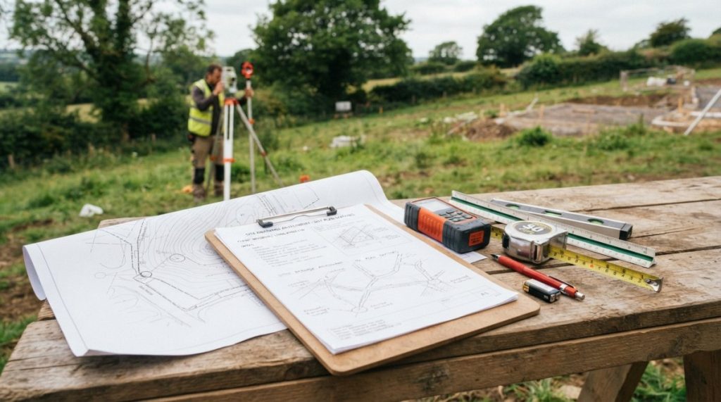
Before designing any drainage system, conduct a thorough site survey. This foundation determines whether your drainage strategy is feasible, compliant, and likely to receive approval. A site survey captures topography, soil conditions, existing infrastructure, and discharge destinations.
Topography, soil conditions, and percolation testing
Topography (ground levels and slopes) dictates how surface water flows across your site. Soil conditions determine permeability and drainage suitability. Clay soils drain poorly and may require piped systems. Sandy or gravelly soils percolate readily and support soakaways.
A percolation test quantifies soil drainage rate by measuring how quickly water soaks into a test pit, following British Standard BS 1377. Results determine whether a soakaway is viable and its required size. Poor percolation means you cannot rely on ground infiltration and must discharge to a sewer or watercourse instead.
Identifying discharge destinations and existing infrastructure
Identify all potential discharge destinations: public sewers, watercourses, soakaways, or neighbouring land. Public sewer connections require consent from the water authority. Discharge to a watercourse requires Environment Agency approval if the watercourse is main river, or local authority consent if it is ordinary watercourse. Locate underground utilities before designing your drainage system. Request utility maps from asset plans held by water companies and utility providers.
Step 2: Design a Compliant Drainage Plan with Professional Engineering
Once site data is gathered, design your drainage plan. A compliant design balances technical feasibility, regulatory requirements, environmental standards, and cost. At The Drainage Designers (Woodvale consulting Ltd), we emphasise that drainage design is not a commodity service. The difference between an approved scheme and a rejected one often lies in how thoroughly the design addresses local authority concerns and SuDS hierarchy principles.
Hydraulic calculations and runoff volumes
Hydraulic calculations predict how much water your system must handle. For surface water, this means calculating runoff volumes based on rainfall intensity, site area, and impervious surface coverage. For foul water, it means estimating daily discharge based on occupancy and fixture use.
Runoff calculations use rainfall data specific to your region. A 1-in-100-year rainfall event (1% annual probability) is the standard design storm for most surface water systems. Discharge rates to public sewers, watercourses, or soakaways are limited by regulation. Most water authorities impose a maximum discharge rate of 5 litres per second per hectare (Qbar).
Pro Tip
Underestimating runoff volumes is a frequent cause of planning rejection. Use conservative rainfall estimates and include a safety margin.
Incorporating sustainable drainage systems and erosion control
Sustainable drainage systems (SuDS) are now mandatory in most UK planning applications. SuDS mimic natural drainage by infiltrating water into the ground, storing it temporarily, or filtering it through vegetation. They reduce flooding, improve water quality, and provide amenity value. Common SuDS elements include permeable paving, swales (shallow vegetated channels), rain gardens, retention ponds, and green roofs. Erosion control protects soil during and after construction through sediment control measures such as silt fences and temporary seeding.
Step 3: Connecting to Public Sewer UK and Alternative Discharge Methods
Connecting to the public sewer is often the simplest drainage solution, but it requires water authority approval and may not always be possible or desirable.
Public sewer connections and water authority approval
Your water company maintains public sewer records (asset plans) showing sewer locations, depths, and capacities. Contact your water company to confirm whether a public sewer is available near your site and whether capacity exists to accept additional discharge.
If a public sewer exists and has capacity, connection is usually straightforward. You must obtain a formal adoption agreement from the water company. If no public sewer is available, or if the nearest sewer is distant or at insufficient depth, connection becomes impractical. In rural areas, private drainage systems (septic tanks, treatment plants, or soakaways) are the norm. Water companies assess sewer capacity before approving new connections.
Soakaways, swales, and retention facilities
Where public sewer connection is not viable or desirable, alternative discharge methods include soakaways, swales, retention ponds, or discharge to a watercourse. A soakaway is a pit or trench filled with permeable material that allows water to infiltrate into the ground. Swales are shallow vegetated channels that collect surface water, filter it through soil, and allow infiltration. Retention ponds store surface water temporarily during heavy rainfall, then release it slowly to a sewer, watercourse, or soakaway.
CIRIA [SuDS design(/17/national-suds-standards-in-plain-english-what-they-mean-for-your-next-planning-submission/) guidance and best practice standards | ciria.org]
Step 4: Implement Sustainable Drainage Systems (SuDS) UK Standards
SuDS compliance is now a planning requirement in most local authorities. Understanding SuDS hierarchy and national standards ensures your design receives approval and delivers long-term environmental benefits.
SuDS hierarchy and national standards compliance
The SuDS hierarchy is a decision-making framework that prioritises infiltration, then storage and treatment, then controlled discharge to a watercourse or sewer.
Tier 1 (infiltration): Design systems that allow water to soak into the ground. This is the preferred option because it recharges groundwater, reduces runoff peaks, and improves water quality. Infiltration is viable only in permeable soils with adequate depth to groundwater and no contamination risk.
Tier 2 (storage and treatment): If infiltration is not viable, design systems that store water temporarily and treat it before discharge. Swales, retention ponds, and filter trenches fall into this tier. They reduce runoff peaks, improve water quality, and provide storage during heavy rainfall.
Tier 3 (controlled discharge): If infiltration and storage are not viable, design systems that discharge to a watercourse or sewer at a controlled rate. Discharge rates are typically limited to greenfield runoff rates (often 5 litres per second per hectare).
National standards for SuDS design are set by CIRIA (Construction Industry Research and Information Association) and endorsed by the Environment Agency and Defra. Local authorities often have supplementary SuDS guidance specific to their area.
Key Takeaway
SuDS is not optional, it is now a planning requirement in most UK authorities. Design your drainage system around SuDS principles from the outset. Retrofitting SuDS into a conventional piped design causes delays and cost overruns.
Rainwater harvesting and climate change resilience
Rainwater harvesting systems capture roof runoff for reuse (toilet flushing, garden watering, car washing). Harvesting reduces both runoff volumes and mains water demand. Climate change resilience is increasingly important in drainage design. Rainfall intensity is increasing across the UK, meaning traditional drainage systems may be inadequate. Modern designs must account for climate projections, typically 20-40% increase in extreme rainfall by 2050.
Step 5: Prepare and Submit Your Planning Application
Once your drainage design is complete and complies with all standards, prepare your planning application. A well-prepared application with complete documentation significantly increases approval chances.
Required documents and submission requirements
Planning applications for drainage require specific documents. Essential documents include a completed planning application form, site plan showing existing and proposed drainage infrastructure, topographical survey showing ground levels, drainage plan showing pipe routes and connection points, hydraulic calculations and runoff volume assessments, percolation test results (if proposing infiltration), flood risk assessment (if required), SuDS strategy document explaining compliance with SuDS hierarchy, maintenance plan for SuDS features, and utility searches confirming location of existing services.
Your local planning authority’s website lists specific requirements. Use these to ensure your submission is complete.
Application forms and site plan approval
The planning application form collects basic project information: applicant details, site location, development description, and proposed use. The site plan is critical. It must clearly show the site boundary, existing buildings and features, proposed drainage infrastructure, and discharge destinations. Use a scale (typically 1:500 or 1:200) that allows detail to be read clearly.
For drainage applications, the site plan must show existing ground levels, proposed drainage features, discharge points, impervious surfaces, vegetation and permeable areas, and utility locations. Submit your application through your local authority’s planning portal. Include all supporting documents as PDFs.
Common Mistakes to Avoid When Seeking Planning Permission for Drainage
Understanding common pitfalls helps you avoid costly rejections and redesigns. The Drainage Designers (Woodvale consulting Ltd) has reviewed hundreds of planning applications and identified recurring mistakes.
Underestimating discharge requirements and asset plans
Many applicants underestimate how much water their site will generate during a design storm. This leads to undersized drainage systems that cannot handle rainfall events. Use conservative rainfall estimates and include a safety margin. Neglecting to obtain asset plans from water companies and utility providers is another frequent mistake. You cannot design a drainage system without knowing where existing utilities are located.
Watch Out
Underestimating runoff volumes and ignoring asset plans are the two most common reasons for planning rejection on drainage grounds. Spend time getting these details right at the outset.
Failing to account for existing easements and rights-of-way
Existing easements and rights-of-way may restrict where you can locate drainage infrastructure. An easement grants someone else (often a utility company or neighbouring property owner) the right to access or use part of your land. Before designing your drainage system, check the property deeds and local authority records for existing easements. Do not locate pipes, soakaways, or retention ponds over easements without consent from the easement holder.
Neglecting sediment control and erosion prevention
Construction of drainage systems can cause erosion and sediment runoff, particularly on sloping sites or near watercourses. Planning conditions often require sediment control and erosion prevention measures. Sediment control includes silt fences, sediment traps, and temporary seeding of exposed soil. Include a detailed erosion control and sediment management plan in your application.
Securing planning permission for drainage requires careful preparation, thorough site investigation, and compliance with complex regulations. The process is manageable with the right approach and professional guidance. The Drainage Designers (Woodvale consulting Ltd) specialises in navigating this process, from initial site surveys through final approval. Our team understands local authority requirements, flood risk assessment standards, and SuDS compliance, the expertise that separates approved applications from rejected ones. Get in touch with The Drainage Designers (Woodvale consulting Ltd) to discuss your drainage project and discover how professional design and planning expertise can deliver your project on schedule.
| Stage | Key Tasks | Timeline | Regulatory Body |
|---|---|---|---|
| Site Investigation | Survey, percolation testing, utility searches, flood zone check | 2-4 weeks | Local authority, water company |
| Design Development | Hydraulic calculations, SuDS strategy, compliance verification | 4-8 weeks | N/A (internal process) |
| Pre-Application Advice | Submit to LPA and LLFA for feedback | 2-3 weeks | LPA, LLFA |
| Application Preparation | Compile documents, finalise drawings, submit application | 1-2 weeks | Local authority |
| Determination | LPA reviews application, consults statutory consultees | 8-13 weeks | LPA, LLFA, water company |
| Approval or Conditions | Receive decision, address conditions if required | Variable | LPA |
Planning Portal guidance on drainage and flood risk applications
Frequently Asked Questions
Do I need planning permission to install a new drain in the UK?
Whether you need planning permission for drainage depends on the type and scale of work. Minor internal drainage improvements may only require building regulation approval. However, significant external drainage works, surface water management, or changes to foul water discharge typically require planning permission. Consult your local planning authority early to confirm requirements for your specific project, as regulations vary by location and flood risk zone.
What is the difference between planning permission and building regulations for drainage?
Planning permission considers the impact on your property and surroundings, including flood risk and sustainable drainage systems (SuDS) compliance. Building regulations ensure the drainage system is safely designed and constructed to national standards. Both are typically required for major drainage work. Planning permission is granted by your local planning authority, whilst building regulations are certified by a building control officer. Confusing the two is a common reason applications are delayed.
What information is needed for a drainage planning application?
A complete drainage planning application requires a site plan showing existing and proposed drainage, a flood risk assessment if in a flood zone, topographical surveys, soil percolation test results, hydraulic calculations, and details of the discharge destination. For sustainable drainage systems (SuDS), include maintenance plans and climate change resilience measures. Your local lead flood authority (LLFA) may request additional asset plans or evidence of water authority consultation. Incomplete submissions are a leading cause of rejection.
What happens if my drainage planning application is refused?
If refused, the council will provide reasons for rejection. Common grounds include inadequate flood risk assessment, failure to meet sustainable drainage standards, or conflicts with local policies. You can resubmit a revised application addressing specific concerns or appeal the decision to the Planning Inspectorate within six months. Engaging a civil engineer to analyse the refusal and strengthen your design significantly improves resubmission success rates. Timeline for appeal resolution typically ranges from three to six months.