Flood Risk Assessment for Planning: A 2026 Guide
Table of Contents
- What is a Flood Risk Assessment for Planning?
- Flood Risk Assessment Requirements You Must Meet
- Understanding Flood Zones and Maps for Planning
- How to Write a Flood Risk Assessment
- Sequential Test Planning: The Core Assessment Framework
- Common Reasons FRAs Get Rejected and How to Avoid Them
- Working with Your Local Planning Authority
- Conclusion
Last Updated: August 11, 2026
What is a Flood Risk Assessment for Planning?
A flood risk assessment for planning is a technical report that evaluates whether a proposed development site faces flooding hazards and what measures can mitigate that risk. It forms a core part of your planning application when the local planning authority or lead local flood authority determines that your site falls within a flood-risk zone or exceeds certain development thresholds.
The assessment demonstrates to the planning authority that your development won’t increase flood risk elsewhere and shows how you’ll manage water on your own site. This is a legal requirement for most developments, and submitting a weak or incomplete assessment is one of the most common reasons planning applications get rejected on drainage grounds. A well-prepared flood risk assessment planning document signals competence and reduces the likelihood of conditions or rejections.
The assessment typically includes baseline site data, an analysis of flood hazards from all sources (fluvial, tidal, surface water, and groundwater), and a clear explanation of how your design responds to those hazards.
Flood Risk Assessment Requirements You Must Meet
Not every development needs a full flood risk assessment. Planning authorities use a tiered approach based on site location and development scale.
When an FRA is mandatory
Your development requires a formal flood risk assessment if any of these conditions apply: your site is in Flood Zone 2 or 3, your development is classified as "more vulnerable" or "highly vulnerable" land use (residential, institutional care, emergency services), your site is larger than 1 hectare in Flood Zone 1, your development includes critical infrastructure, or your site involves changes to surface water drainage that affect more than 0.5 hectares.
The Environment Agency’s Flood Map for Planning shows which zone your site occupies. If you’re in Zone 1 (lowest risk) and your development is small-scale, you may only need a proportionate assessment. But if you’re in Zone 2 or 3, a comprehensive flood risk assessment planning document is required.
A common mistake is assuming that because a site is in Zone 1, no assessment is needed. Surface water flooding, groundwater flooding, and drainage from neighbouring land can create hazards even in low-risk zones. Check your local planning authority’s guidance to clarify what they expect for your specific location and development type.
Development types that trigger FRA requirements
Residential extensions and new houses almost always require an assessment if the site is in Flood Zone 2 or 3. Commercial developments, industrial sites, and mixed-use schemes trigger requirements at lower thresholds. Change of use to residential, care homes, hospitals, or emergency facilities requires assessment regardless of flood zone.
Temporary structures, agricultural buildings, and minor works may be exempt, but check your local planning authority’s development management guidance before deciding a full assessment isn’t needed.
Understanding Flood Zones and Maps for Planning
Flood zones define the statistical probability of flooding in any given year. The Environment Agency divides England into three zones based on annual flood probability.
Flood Zone 1, 2, and 3 explained
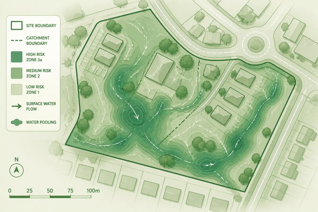
Flood Zone 1 represents the lowest risk: less than 1 in 1,000 annual probability of fluvial or tidal flooding. Most development is acceptable here with minimal mitigation. Flood Zone 2 carries medium risk: between 1 in 100 and 1 in 1,000 annual probability. Residential development is possible but requires flood-resilient design and clear mitigation strategies. Flood Zone 3a represents high risk: greater than 1 in 100 annual probability. Residential development is restricted and only permitted where the sequential and exception tests are passed.
Flood Zone 3b, the functional floodplain, is where water is designed to flood during extreme events. New residential development is generally not permitted here.
Your flood risk assessment planning submission must clearly identify which zone applies and explain how your design responds to that classification. Misidentifying your flood zone is a common rejection trigger.
How to check your site’s flood zone
Visit the Environment Agency’s Flood Map for Planning website and enter your postcode or site address. The tool returns your flood zone classification for both fluvial and surface water flooding. Print or screenshot the result and include it in your submission.
The flood map also shows historical flood extents and areas at risk from surface water flooding. If your site falls within a historical flood extent, your assessment must explain why the development is still appropriate and what mitigation prevents future incidents.
Contact your planning department early to understand their specific requirements and any local flood risk information they hold.
How to Write a Flood Risk Assessment
A flood risk assessment planning document follows a standard structure: site description and baseline conditions, flood risk evaluation from all sources, impact assessment, mitigation and resilience measures, and conclusions.
Step 1: Gather site data and baseline conditions
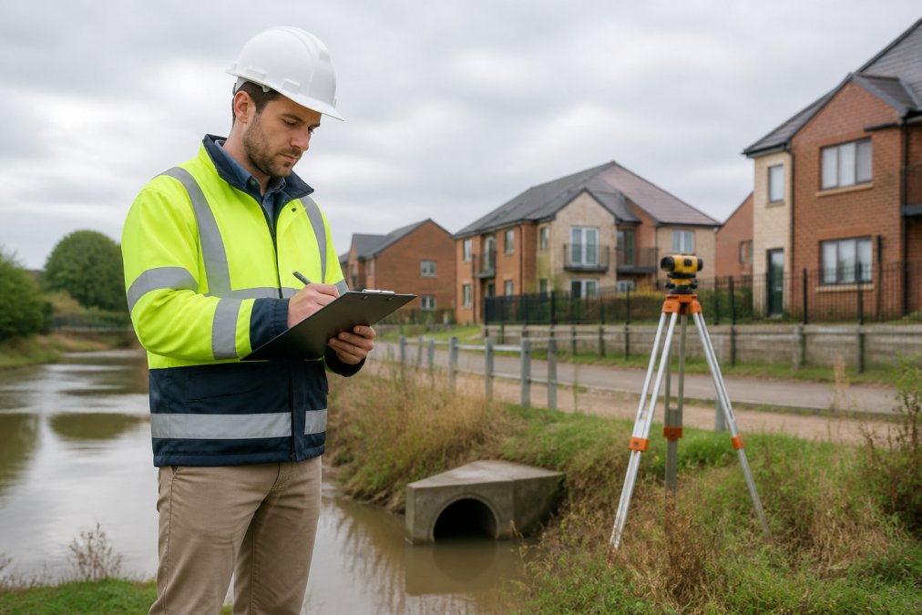
Start with a detailed site survey. Document existing ground levels, drainage infrastructure, watercourses, surface water features, and historical flood events. Measure the finished floor levels you’re proposing and calculate how they relate to predicted flood levels. Obtain historical flood records from the Environment Agency and local flood authority. Check planning records for previous applications on the site or nearby developments that might reveal local drainage constraints.
A flood risk assessment planning submission built on incomplete or inaccurate baseline data will be challenged. The local planning authority expects you to have visited the site, understood the existing conditions, and documented them systematically.
Step 2: Apply the Sequential Test and Exception Test
The sequential test requires you to demonstrate that you’ve considered whether the development could be located elsewhere at lower flood risk. For most residential extensions and small developments, this is straightforward: the site is fixed, and relocation isn’t practical. For larger schemes, you must show that you’ve evaluated alternative sites and chosen the lowest-risk option.
The exception test applies when a development is necessary for the local economy or meets other policy objectives, but the sequential test can’t be fully passed. It requires two conditions: the development must provide wider sustainability benefits that outweigh the flood risk, and you must demonstrate that the flood risk can be managed safely through design and mitigation.
Step 3: Document mitigation and resilience measures
Mitigation reduces the likelihood or magnitude of flooding. Resilience allows the building to withstand or recover from flooding. Both are essential components of your assessment.
Mitigation measures include raising finished floor levels above predicted flood levels, installing sustainable drainage systems to manage surface water on-site, creating flood storage areas, and improving site drainage. Resilience measures include flood-resistant materials below predicted flood levels, demountable flood barriers, and design features that allow water to flow through rather than accumulate against structures.
Your assessment must explain why you’ve chosen each measure, how it performs during different flood scenarios, and how it integrates with the overall site design.
Sequential Test Planning: The Core Assessment Framework
The sequential test is the primary policy tool for managing flood risk in new development.
How the Sequential Test works
The sequential test requires developers to demonstrate that their proposed development is appropriate for the flood zone where it’s located. For Zone 1 and most Zone 2 development, you confirm the zone, show that your development type is compatible with that zone, and outline your mitigation approach.
For Zone 3 development or highly vulnerable uses, the test is more rigorous. You must show that you’ve evaluated alternative sites at lower flood risk and either found none or demonstrated that the chosen site offers overriding sustainability or policy benefits.
Document your sequential test reasoning clearly in your assessment. Make the case explicitly: "Alternative sites at lower flood risk were evaluated but rejected because [specific constraint]."
When the Exception Test applies
The exception test is a backstop for developments that fail the sequential test but are still deemed acceptable because they deliver sufficient wider benefits. This applies when your development is necessary for the local economy, provides essential public services, or meets other material planning considerations that outweigh the flood risk.
Using the exception test is higher risk and requires stronger evidence that the development is necessary and that flood risk can be managed safely. Most domestic extensions and small commercial developments don’t invoke the exception test.
Common Reasons FRAs Get Rejected and How to Avoid Them
Planning authorities reject flood risk assessments for predictable reasons. Most rejections aren’t about the science; they’re about incomplete documentation, unclear reasoning, or failure to address policy requirements.
Insufficient baseline data is the most common issue. Always document your sources: Environment Agency data, local authority records, site surveys, or specialist reports. If you’re relying on assumptions, state them clearly and explain why they’re reasonable.
Inadequate mitigation measures is the second major reason. The assessment must specify the type of mitigation, its design capacity, how it’s maintained, and what happens during a 1 in 100 year flood event plus climate change allowance.
Failure to address climate change is increasingly common. Use the latest Environment Agency climate change allowances and demonstrate how your finished floor levels and mitigation measures account for increased rainfall and higher flood levels in future decades.
Unclear sequential and exception test reasoning causes rejections. State explicitly whether the sequential test is passed or failed, and if failed, explain why the exception test applies.
Missing or incomplete sustainable drainage systems assessment is another frequent issue. Your assessment must demonstrate how surface water will be managed on-site, how the system performs during design storms, and how it integrates with flood mitigation.
Working with Your Local Planning Authority
The local planning authority and lead local flood authority are your primary reviewers. Understanding their expectations and engaging with them early reduces rejection risk substantially.
What the LPA expects in your submission
Your local planning authority will expect a technical report structured according to their guidance. Most authorities follow the Environment Agency’s framework, but some add local requirements. Request their development management guidance before you start writing. Ask specifically whether they have supplementary flood risk guidance, local drainage standards, or particular concerns about your area.
Submit a draft assessment for pre-application consultation if possible. This catches issues before formal submission. Your submission should be clear, well-organised, and honest about limitations. Planning authorities respect transparent assessment more than overly optimistic claims.
Sustainable Drainage Systems and Lead Local Flood Authority sign-off
Sustainable drainage systems (SuDS) are now a policy requirement for most new development. Your flood risk assessment planning document must include a detailed SuDS design that manages surface water on-site, reduces runoff, and improves water quality.
The lead local flood authority (usually your local council’s drainage team) must approve your SuDS design before planning permission is granted. Coordinate with them early. Different authorities have different standards for infiltration rates, storage volumes, and maintenance regimes.
Common SuDS approaches include permeable paving, swales, retention ponds, and underground storage. Your assessment should explain which approach is suitable for your site, how it was designed, and how it will be maintained long-term.
| Common FRA Rejection Reason | How to Avoid It | Impact on Timeline |
|---|---|---|
| Insufficient baseline data | Document all sources; include site survey evidence | Typically adds 2-4 weeks to resubmission |
| Vague mitigation measures | Specify design, capacity, and performance scenarios | Often requires specialist redesign |
| Missing climate change allowances | Use latest Environment Agency guidance; apply to all flood levels | May trigger re-assessment of finished floor levels |
| Unclear sequential/exception test | State explicitly whether passed or failed; explain reasoning | Resubmission usually needed; may require alternative site analysis |
| Incomplete SuDS assessment | Design to local authority standards; address maintenance | Coordination with lead local flood authority required |
Flood risk assessment planning is technical, but it’s also procedural. Most rejections happen because applicants underestimate the detail required or fail to engage with their local planning authority early. Start with a site survey, confirm your flood zone, understand your authority’s specific requirements, and build your assessment around evidence rather than assumptions. The Drainage Designers (Woodvale consulting Ltd) simplifies this process with comprehensive site assessment, expert technical reporting, and direct coordination with local authorities to maximise approval prospects and keep your project on schedule.
Frequently Asked Questions
Do I need a flood risk assessment for planning permission?
Yes, if your development falls within certain thresholds. Any development on land in Flood Zones 2 or 3 requires an FRA. In Flood Zone 1, an FRA is needed for developments over 1 hectare or those that increase flood risk elsewhere. Your local planning authority will confirm requirements based on your site location and development type. Checking the Flood Map for Planning early in your project prevents costly delays later.
What information must be included in a flood risk assessment?
Your FRA must include site location and baseline flood risk data, details of the proposed development and how it affects flood risk, mitigation and resilience measures (such as finished floor levels and SuDS), and evidence that the Sequential Test has been passed. For larger schemes, you'll need to address climate change allowances, surface water drainage strategy, and emergency escape routes. The Local Planning Authority and Lead Local Flood Authority will review these sections before approval.
What is the difference between the Sequential Test and Exception Test in flood risk assessment planning?
The Sequential Test directs development away from high-flood-risk areas to lower-risk sites. If a lower-risk site isn't available and your development is essential, the Exception Test allows it to proceed if it provides wider sustainability benefits and includes flood resilience measures. Most residential and commercial projects pass via the Sequential Test. The Exception Test applies when development in a higher-risk zone is justified by planning policy or social need.
How do I check if my site is in a flood risk area?
Use the Flood Map for Planning tool on the Environment Agency website to determine your site's flood zone (1, 2, 3a, or 3b). Enter your postcode or site address to view fluvial and tidal flood risk. You should also check for surface water flooding and groundwater risk using the same tool. This is your first step before commissioning an FRA. Local planning authorities will cross-reference this data with your formal assessment.
Can I write my own flood risk assessment?
Technically yes, but FRAs require technical expertise in hydrology, drainage design, and planning policy compliance. Errors or omissions lead to rejection and project delays. Most councils expect assessments from qualified professionals who understand local flood risk management strategies and SuDS requirements. If you lack drainage or hydrological background, outsourcing to specialists ensures your application meets standards and passes first time.
What happens if my flood risk assessment is rejected by the council?
The council will issue a detailed reason for rejection, typically citing insufficient mitigation measures, inadequate drainage design, or failure to address Sequential or Exception Test requirements. You'll need to revise the assessment, address the specific concerns, and resubmit. Common reasons include underestimated flood risk, poor SuDS integration, or missing climate change allowances. Early engagement with your Local Planning Authority and Lead Local Flood Authority prevents rejection in the first place.
How long does a flood risk assessment take to complete?
A straightforward FRA typically takes 3-6 weeks from site survey to final report, depending on site complexity and data availability. Larger developments or those requiring detailed hydrological modelling may take 8-12 weeks. Timeline includes site visits, data gathering, analysis, mitigation design, and council liaison. Starting the FRA early in your planning process prevents delays. Engaging specialists early ensures your assessment aligns with local authority expectations and planning deadlines.
This article was written using GrandRanker