What Is a Flood Risk Assessment Report: A UK Guide
Table of Contents
- What Is a Flood Risk Assessment Report?
- When Is a Flood Risk Assessment Report Required for Planning Permission?
- Key Components of a Flood Risk Assessment Report Template
- Sources of Flood Risk: Fluvial, Surface Water, Tidal and Groundwater
- Flood Mitigation Measures and Sustainable Drainage Systems in the UK
- Using Environment Agency Flood Maps for Planning Applications
- Common Reasons Planning Applications Are Rejected on Flood Risk Grounds
- Initial Site Screening: A DIY Checklist Before Commissioning a Full Assessment
Last Updated: August 2, 2026
What Is a Flood Risk Assessment Report?
A flood risk assessment report is a detailed technical document that evaluates the likelihood and potential impact of flooding on a specific site or development. This guide from The Drainage Designers (Woodvale consulting Ltd) explains what these assessments contain, why they matter for planning permission, and how they shape development decisions across the UK.
The report combines hydrological analysis, topographical surveys, and climate projections to determine whether a proposed development can safely proceed and what mitigation measures will be needed. For homeowners planning extensions, architects designing new buildings, and developers managing larger projects, this document becomes the foundation of planning approval. According to guidance from the Environment Agency, flood risk assessments are mandatory for most development sites in England, Wales, Scotland, and Northern Ireland.
The most common mistake is assuming a flood risk assessment is optional for small projects. Even modest domestic extensions on certain sites require a [formal assessment](/567/what-is-flood-risk-assessment/) if the site falls within a flood zone or has a history of surface water issues. Starting the process early saves months of delays later.
When Is a Flood Risk Assessment Report Required for Planning Permission?
Planning permission requirements for flood risk assessments depend on the flood zone where the site sits, the scale and type of development, and the vulnerability classification of the proposed use. The local planning authority and Lead Local Flood Authority both have statutory responsibilities to scrutinise flood risk before granting consent.
Development sites and flood zone designations
The Environment Agency divides England into flood zones based on probability of fluvial (river) flooding. Zone 1 represents the lowest risk, Zone 2 represents medium risk, and Zone 3 represents high risk. However, flood zones are only part of the picture. Surface water flooding, tidal flooding, groundwater flooding, and sewer flooding are equally important considerations.
Development in Zone 1 typically requires no formal flood risk assessment unless the site is larger than 1 hectare or involves particularly sensitive uses. Development in Zone 2 or Zone 3 almost always requires a detailed assessment. The assessment must demonstrate that the sequential test has been passed: that the development cannot reasonably be located in a lower-risk zone.
Environment Agency flood risk mapping guidance
For sites with a history of flooding or surface water issues, even Zone 1 sites may require assessment. Local planning authorities increasingly request assessments for any development near watercourses, in areas with poor drainage, or where climate change projections suggest future flood risk will increase significantly.
Sequential test and vulnerability classification
The sequential test requires developers to demonstrate they have considered alternative sites at lower flood risk. If no such alternative exists, the development can proceed in a higher-risk zone provided the flood risk assessment proves adequate mitigation is feasible.
Vulnerability classification determines how sensitive a use is to flooding. Residential properties, particularly those with sleeping accommodation, are classified as "more vulnerable". Commercial offices are "less vulnerable". This classification influences whether a development can proceed in certain flood zones and what mitigation measures the assessment must recommend.
Key Components of a Flood Risk Assessment Report Template
A comprehensive flood risk assessment report contains several essential sections. Understanding these components helps you anticipate what information the local planning authority will expect and what The Drainage Designers (Woodvale consulting Ltd) will need from you to produce a compliant document.
Site-specific assessment and technical evaluation
The assessment begins with a detailed site-specific evaluation including a topographical survey showing ground levels, existing drainage features, and site boundaries. The technical evaluation examines historical flood records, existing flood defences, and the current state of drainage infrastructure serving the site.
The report describes the development proposal in detail: building footprints, finished floor levels, proposed uses, and how surface water will be managed. It identifies all potential sources of flood risk affecting the site. Site-specific assessment also evaluates access and egress during flood events, ensuring residents or emergency services can reach the building safely if flooding occurs.
Hydrological analysis and flood hazard mapping
Hydrological analysis uses rainfall data, river flow records, and hydraulic modelling to predict flood depths, velocities, and extents under various scenarios. The assessment typically models a 1-in-100-year flood event (1% annual probability) for river flooding and a 1-in-30-year event (3.3% annual probability) for surface water flooding. Climate change projections are applied to account for increased rainfall intensity and river flows expected over the development’s lifetime.
Flood hazard mapping translates this analysis into visual representations showing which areas of the site would be inundated, to what depth, and with what velocity during a design flood event. These maps become the basis for determining whether the development is feasible and what mitigation measures are needed.
DEFRA flood and coastal erosion risk management guidance
Sources of Flood Risk: Fluvial, Surface Water, Tidal and Groundwater
Flood risk comes from multiple sources, and a compliant assessment must evaluate all of them. Fluvial flooding is the most familiar type, but surface water flooding now causes more property damage in many parts of the UK.
Fluvial flooding occurs when rivers exceed their capacity during heavy rainfall or snowmelt. The Environment Agency maintains flood maps showing areas at risk from river flooding. Fluvial risk depends on proximity to the watercourse, ground elevation, and the presence of flood defences.
Surface water flooding happens when rainfall cannot infiltrate the ground or drain away quickly enough, causing water to pond on the surface. This risk depends on local topography, soil permeability, and the capacity of surface water drainage systems.
Tidal flooding affects coastal and estuarine areas where sea level rise, storm surge, and high tides combine to inundate low-lying land. Tidal flood risk is increasing due to climate change and subsidence in some regions.
Groundwater flooding occurs when water tables rise above ground level, typically in areas with chalk, limestone, or other permeable geology. This risk can be severe and long-lasting.
Understanding flood zones and Environment Agency flood maps
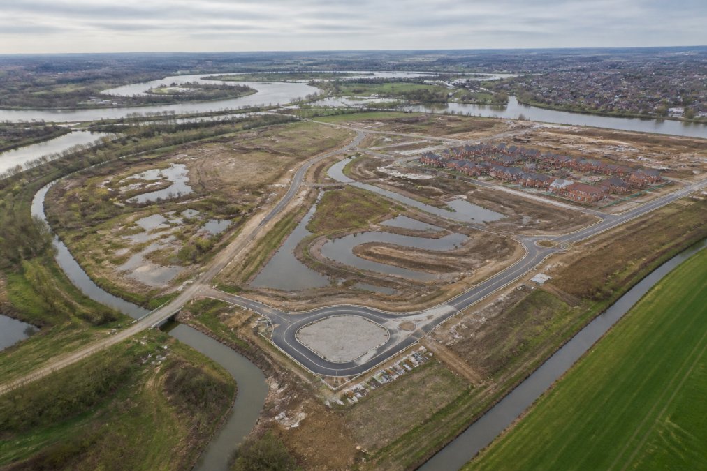
Environment Agency flood maps are the starting point for any flood risk assessment. These maps show areas at risk from fluvial and tidal flooding at a broad level. However, they do not account for surface water flooding (which requires separate mapping) and may not reflect local knowledge of historical flooding or the impact of recent drainage improvements.
The local planning authority will cross-reference the site against Environment Agency flood maps and local flood risk data. Many sites fall into what planners call the "grey area": not clearly in a flood zone according to Environment Agency data, but with evidence of historical flooding or surface water issues. These sites often require assessment to resolve the uncertainty and give the local planning authority confidence to approve.
Flood Mitigation Measures and Sustainable Drainage Systems in the UK
Once the flood risk assessment identifies the hazard, it must propose mitigation measures to reduce the risk to an acceptable level. Mitigation strategies fall into two broad categories: flood resistance and flood resilience.
Flood resistance measures prevent water from entering the building. These include raising finished floor levels above the predicted flood level, installing flood barriers or demountable defences, waterproofing external walls, and sealing service penetrations.
Flood resilience measures allow water to enter but minimise damage. These include using water-resistant materials in flood-prone areas, removing fitted carpets and replacing them with hard flooring, locating services above the predicted flood level, and designing buildings so that water can drain away quickly once the flood recedes.
Sustainable drainage systems (SuDS) form the cornerstone of modern flood risk management. Rather than piping surface water away rapidly, SuDS slow it down, allow infiltration, and recharge groundwater. Permeable paving, rain gardens, attenuation ponds, and green roofs are all SuDS techniques. The assessment must demonstrate how surface water from the development will be managed using SuDS principles, in line with local planning authority and Lead Local Flood Authority requirements.
The best mitigation strategy combines multiple approaches: reducing the amount of impermeable surface, slowing surface water runoff with SuDS, raising critical building services, and designing the building to be resilient if water does enter.
Using Environment Agency Flood Maps for Planning Applications
Environment Agency flood maps are a starting point, not the final word. The local planning authority will use them to screen applications, but a thorough flood risk assessment goes much deeper.
Interpreting flood risk data and local planning authority requirements
Flood maps show broad-brush risk but lack the precision needed for site-specific decisions. A property shown in Zone 2 on the map might actually be at lower risk due to local topography or existing defences. Conversely, a property shown in Zone 1 might be at risk from surface water or groundwater flooding not captured in the map.
The flood risk assessment interprets the map data in the context of the specific site. It explains what the map shows, what it does not show, and how the site’s actual risk compares to the mapped risk. Local planning authorities have different expectations depending on the local flood risk context. Authorities in areas with a history of flooding tend to require more detailed assessments and stronger mitigation measures.
Planning Practice Guidance on flood risk
Common Reasons Planning Applications Are Rejected on Flood Risk Grounds
Planning applications are rejected on flood risk grounds more often than many applicants expect. Applications fail when the flood risk assessment is incomplete or inadequate. Missing analysis of surface water flooding, failure to consider climate change projections, or inadequate evaluation of mitigation measures are frequent problems.
Applications fail when the proposed mitigation measures are not credible or enforceable. The assessment might propose SuDS that the site cannot physically accommodate, or mitigation that depends on ongoing maintenance that no one will fund. Inadequate consideration of the sequential test also causes rejections. If the application fails to demonstrate that alternative sites at lower flood risk have been genuinely considered, the local planning authority may reject the application even if mitigation is technically feasible.
Initial Site Screening: A DIY Checklist Before Commissioning a Full Assessment
Before commissioning a full flood risk assessment from The Drainage Designers (Woodvale consulting Ltd) or another consultant, you can screen your site to understand whether an assessment is likely to be required and what issues might emerge.
| Check | What to Look For | Action If Found |
|---|---|---|
| Environment Agency flood zone | Is the site in Zone 2 or Zone 3? | Formal assessment likely required |
| Local flood risk data | Has the site or nearby area flooded historically? | Request local authority flood records |
| Topography | Is the site in a valley or low-lying area? | Surface water risk may be significant |
| Drainage | Are there ditches, streams, or poor drainage nearby? | Assess surface water and groundwater risk |
| Soil type | Is the soil clay (poor drainage) or sandy (good drainage)? | Affects SuDS feasibility and groundwater risk |
| Development size | Is the site larger than 1 hectare? | Assessment required regardless of flood zone |
| Use type | Is the proposed use residential or sensitive? | More stringent requirements apply |
| Climate projections | Are rainfall intensities increasing in your region? | Future-proof mitigation becomes essential |
Start by checking the Environment Agency flood maps online. Identify the flood zone, note any flood defences, and look for watercourses. Contact your local planning authority and ask whether they hold records of historical flooding on the site or in the surrounding area. Speak to neighbours about their experience with flooding or drainage problems.
If the site is in Zone 1 and you find no evidence of historical flooding, a formal assessment may not be required. However, if there is any uncertainty, commissioning an assessment early is far cheaper than having a planning application rejected and having to resubmit with additional information.
The Drainage Designers (Woodvale consulting Ltd) can advise on whether your site requires a formal assessment and, if so, what scope of work will be needed to satisfy the local planning authority.
Underestimating flood risk is a common and costly mistake. Sites that appear to be at low risk on Environment Agency maps sometimes have serious surface water or groundwater flooding issues that only become apparent during a detailed assessment. Discovering this after planning permission has been granted, or worse, after construction has begun, leads to expensive remedial work and potential liability.
Flood risk assessment is no longer optional for most developments in the UK. Planning authorities are increasingly stringent in their requirements, and climate change projections suggest that flood risk will intensify over the coming decades. A thorough, credible assessment gives you confidence that your development can proceed safely and helps you secure planning approval without costly delays or rejections.
The Drainage Designers (Woodvale consulting Ltd) specialises in flood risk assessments tailored to your specific site and your local planning authority’s requirements. From initial screening through detailed hydrological modelling, SuDS design, and mitigation strategy, we deliver assessments that satisfy statutory requirements and protect your investment. Get in touch with The Drainage Designers (Woodvale consulting Ltd) to discuss your site’s flood risk and how we can help secure planning permission with confidence.
Frequently Asked Questions
When is a flood risk assessment report required for planning permission in the UK?
A flood risk assessment report is required if your development site falls within a flood zone designated by the Environment Agency, or if it involves major development over 1 hectare in areas of lower flood risk. The requirement depends on the development type, site location, and local planning authority guidance. Check your local authority's planning policy and the Environment Agency flood maps to determine whether your project needs an assessment before submitting a planning application.
What information should be included in a flood risk assessment report template?
A comprehensive flood risk assessment report template must include a site-specific assessment, hydrological analysis of flood sources (fluvial, surface water, tidal, and groundwater), flood hazard mapping, vulnerability classification of the development, and proposed flood mitigation measures such as Sustainable Drainage Systems (SuDS). It should also address how the development complies with the sequential test and local planning authority requirements, and include a topographical survey and technical evaluation of flood risk management strategies.
What are the main sources of flood risk assessed in a flood risk assessment report?
The main sources include fluvial flooding (from rivers), surface water flooding (from heavy rainfall and poor drainage), tidal flooding (in coastal areas), groundwater flooding (from rising water tables), and sewer flooding. A flood risk assessment examines which sources pose a threat to your specific development site by analysing Environment Agency flood maps, historical flood data, and site-specific conditions. Understanding these sources helps determine appropriate flood resilience and flood resistance measures for your project.
Can I do an initial site screening myself before commissioning a full flood risk assessment?
Yes, you can perform a preliminary check using the Environment Agency flood map online, which shows flood zones and historical flood extents. Check whether your site is in a flood plain, review local topography using mapping tools, and identify nearby watercourses or drainage systems. However, a full technical flood risk assessment must be carried out by a qualified professional to meet planning requirements. This initial screening helps you understand whether a formal assessment is needed and what mitigation measures might be required before you invest in a detailed report.
This article was written using GrandRanker